National Day of Civic Hacking:

Let's explore education data
with Leaflet & D3!


HTML, CSS, and JavaScript have been the 3 core languages making up modern web pages.

They are supported by all modern web browsers.

What is a library? (not the book kind)


Libraries are pre-written code.

They let you create robust web applications easily. Someone else has done all the hard work!


Leaflet js is a library for making interactive web maps

Reasons to use Leaflet:

  • maps tell a story
  • lots of examples to borrow from
  • integration with D3 js


D3 js is a library for making interactive graphs/charts

Reasons to use D3 js:

  • graphs help us understand data
  • lots of examples to borrow from
  • integration with Leaflet


Today we'll use DC js and Crossfilter js which are libraries that make it easy to display filtered data

This sounds like a lot of libraries to deal with,
but it will make it easier

How do I start?

First we need data!

We'll use data from the California Department of Education: Public Schools

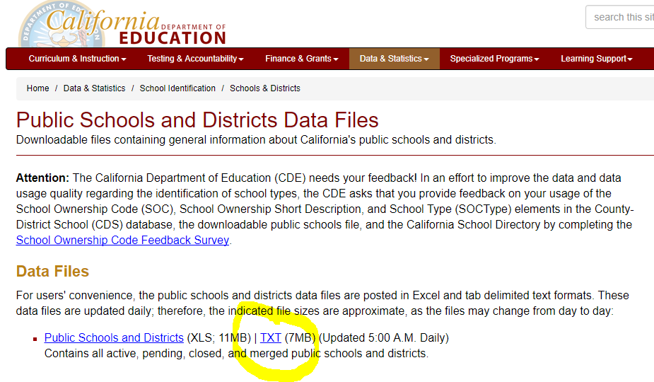
Just download the txt file and change the extension to ".tsv". It's a tab delimited file.

We want to keep the same data schema as the source so updates are simple.


You'll also need a code editor.

There are a lot out there. I prefer Atom.


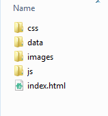
If you are starting from scratch, next you'll set up your folders


Now you can add all the dependencies as you go, like:
  • data
  • images
  • css files
  • js files


And to make life easier, use a version control manager like GitHub


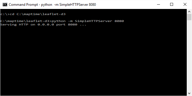
You can use Python to turn any folder into a web server for testing:


Then use gh-pages in GitHub to share your creation with the world for free!

But wait, how do I know what code to write?


Just take inspiration from others:
  • DC js examples
  • Dashboards with Crossfilter tutorial
  • DC js + Leaflet example
  • DC js + Leaflet tutorial


You can even steal the code from this presentation!

Actually, please do steal it and make it better!


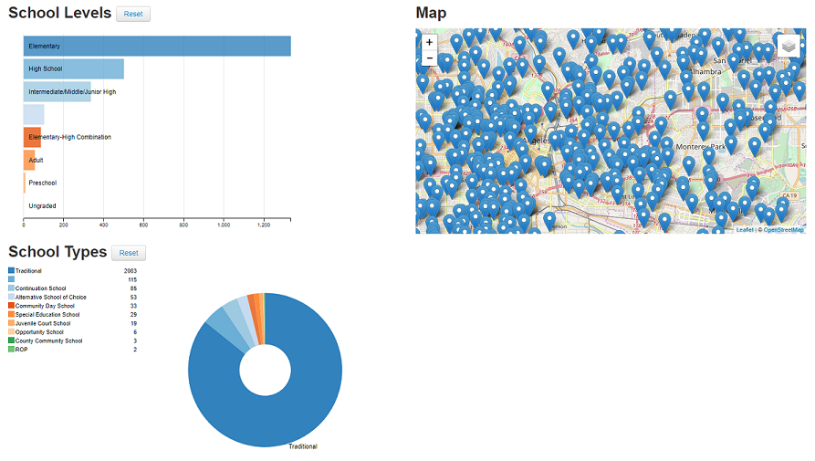
Here's what the example shows:


We have 2 DC js charts and the Leaflet js map.
And everything is linked!


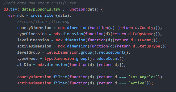
Set up the filters (because the table is too big to digest at once):


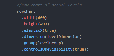
Now we can make the row chart:
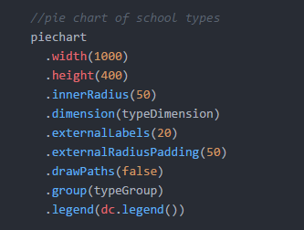

And the pie chart:


Then we tackle the map! It's hinged on a chart to take advantage of DC js:


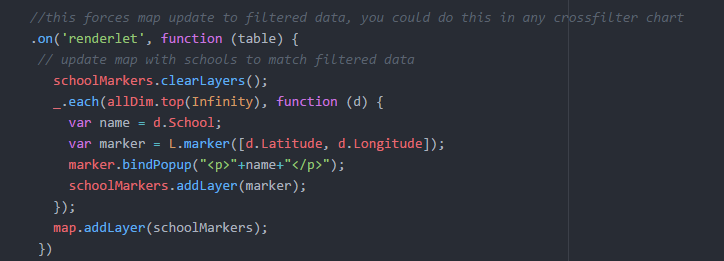
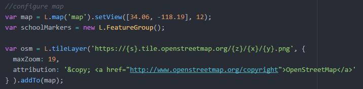
But the map itself is good old Leaflet!

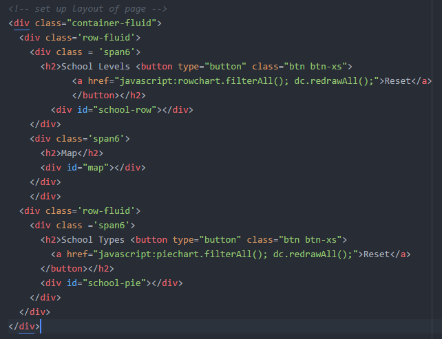
Then we piece it together in html (this uses Bootstrap, but you don't have to):


If this interests you, please join us at Maptime!

Thanks!

@bondaharper