MaptimeLA presents:
Python +
BeautifulSoup +
QGIS
=Awesome!
#maptimeLA
MaptimeLA presents:
Python +
BeautifulSoup +
QGIS
=Awesome!
#maptimeLA
Python is a programming language.
It is commonly used in GIS, math, and science.
Python has a lot of libraries.
These contain code you can use via shortcuts.
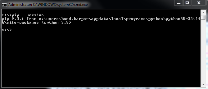
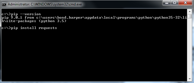
Use pip for installing libraries. Recent installs should come with pip. Use pip --version to check in command line.
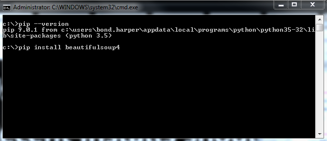
Use pip (or your preferred method) to install BeautifulSoup4:
pip install beautifulsoup4
BeautifulSoup is a library for extracting data from html and xml.
Use pip (or your preferred method) to install requests:
pip install requests
Requests is a library for extracting data from html and xml.

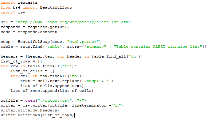
Let's write some Python to get the gages from this LA County page as a csv.
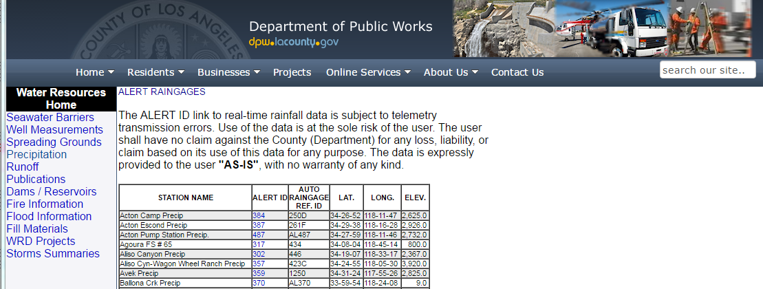
But first, inspect the page to learn more about the structure of the data we want.
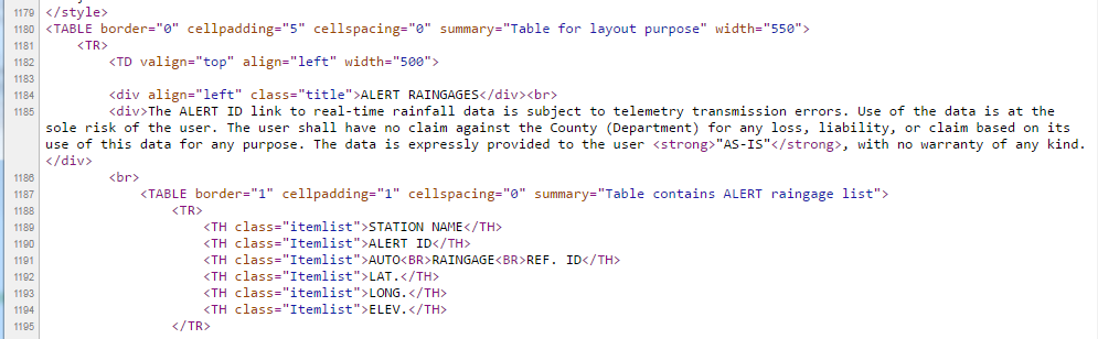
Parse the table together:
Time for QGIS!
QGIS is a free geographic information system software for making maps and analyzing spatial data.
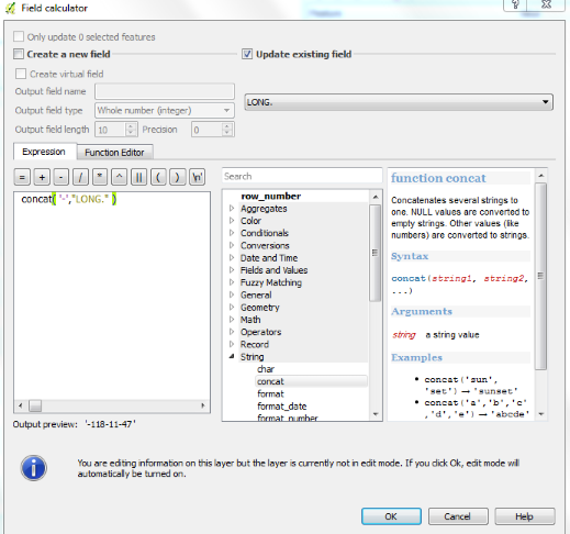
The longitude is missing the negative sign. We will add it in QGIS:
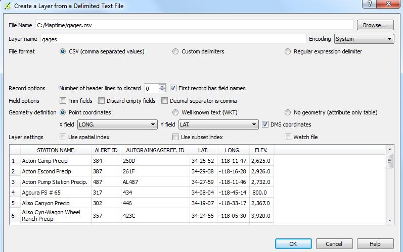
Now we can add the table as points.
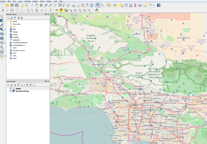
Turn on the basemap using OpenLayers and save as a shapefile.
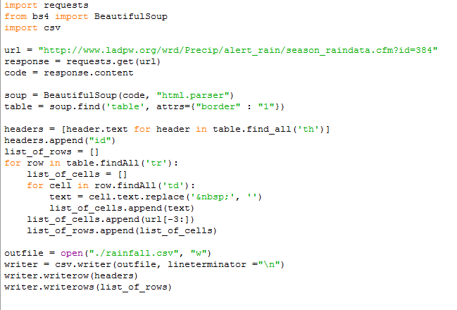
Now let's write some Python to get the rainfall from individual gages as a csv.
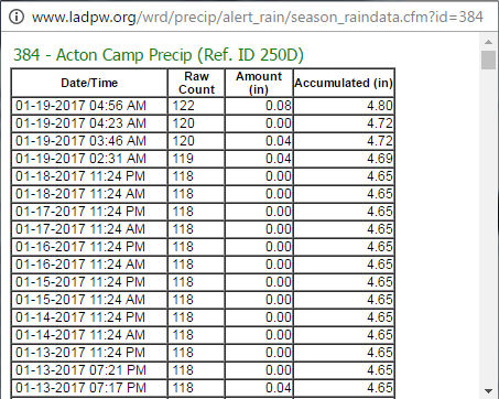
But first, inspect the page to learn more about the structure of the data we want.
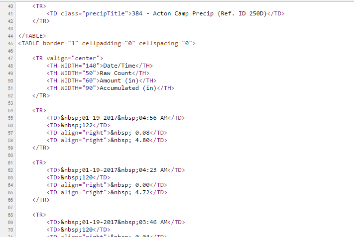
Python for individual gage:
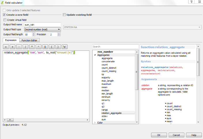
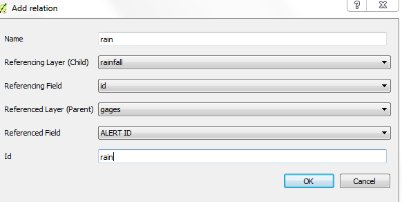
Now we are going to use relations in QGIS to relate the rain to our gage points:
Now what can you do? As an example we could sum and color the gage by rainfall: